In the realm of insurance claims, navigating the intricate processes and paperwork can be an arduous task for homeowners seeking fair compensation after disasters or damages. Caliber Public Adjusters, a pioneering name in the industry, has taken innovation to the skies and beyond, harnessing the power of cutting-edge technologies like drones, LiDAR, and aerial satellite imaging to streamline the claims settlement process. By offering a free blueprint of your home and expertly negotiating with insurance companies, Caliber is redefining how homeowners receive the compensation they deserve.
Drones: Aerial Insights for Precise Assessments
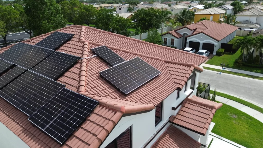
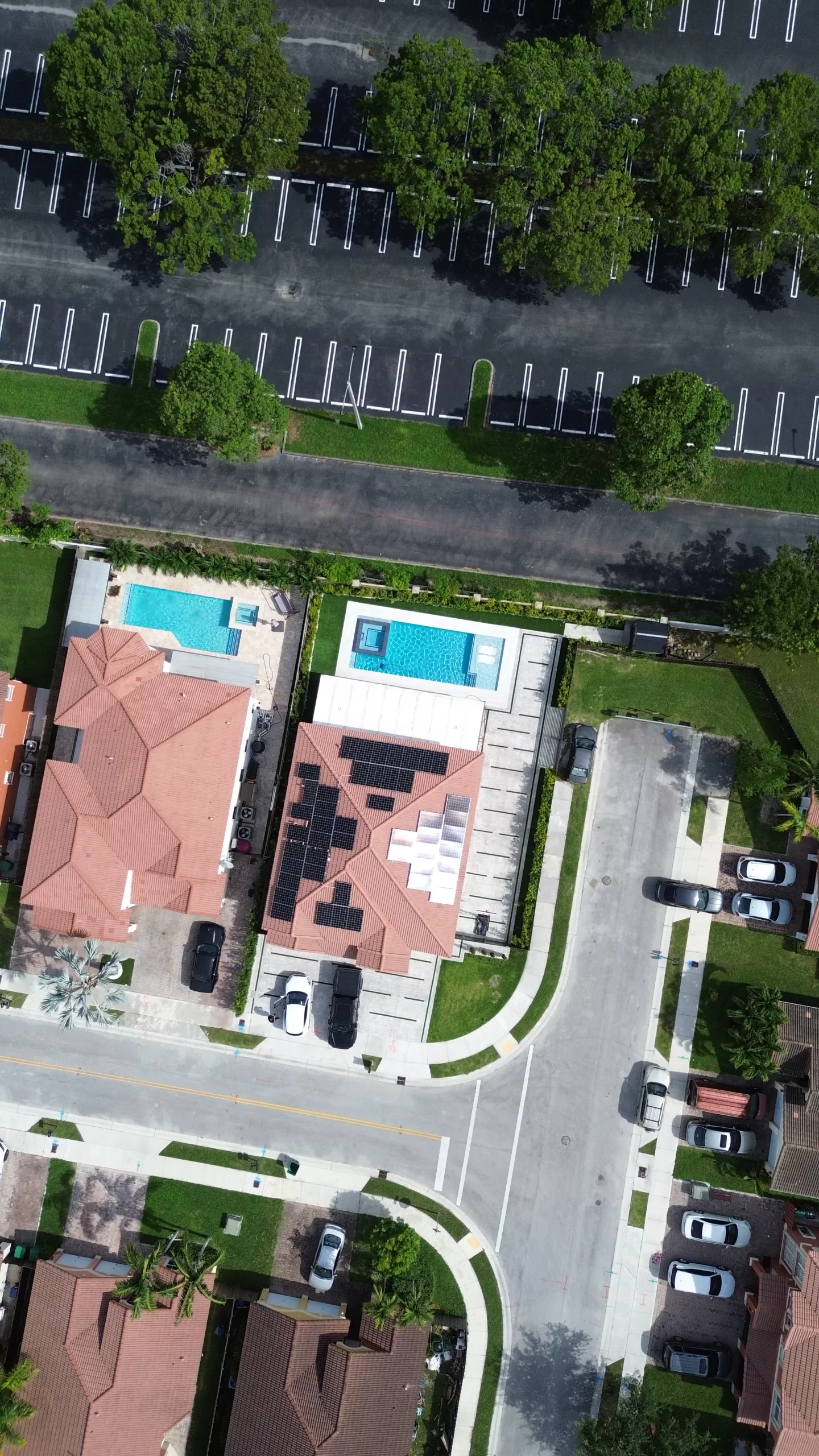
One of the remarkable advancements that Caliber Public Adjusters has incorporated into its operations is the use of drones. Drones are deployed to capture high-resolution aerial imagery of properties, allowing for comprehensive assessments of damages. Whether it’s roof damage from storms or structural issues caused by natural disasters, drones provide a bird’s-eye view that was once a luxury in the claims process.
By flying over properties and capturing detailed images, drones enable adjusters to assess the extent of damage with unmatched accuracy. This visual data eliminates the need for guesswork and subjective evaluations, ensuring that homeowners are compensated fairly for every bit of damage.
LiDAR Technology: Precision in 3D
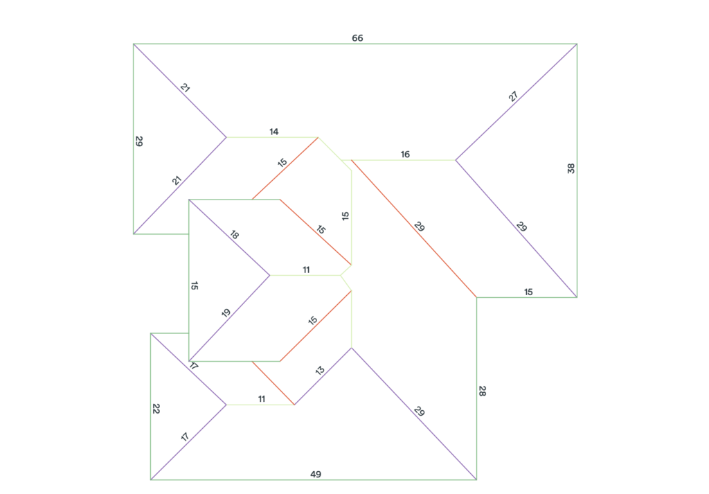
LiDAR (Light Detection and Ranging) technology takes property assessment to the next level by creating highly detailed three-dimensional models of structures and landscapes. Caliber Public Adjusters employs LiDAR to produce accurate measurements of properties, which aids in assessing damages, calculating rebuilding costs, and determining the scope of necessary repairs.
LiDAR’s ability to map the environment with precision is particularly valuable when dealing with complex damages that might not be easily visible through traditional inspection methods. By merging LiDAR data with other technology-driven insights, Caliber enhances the accuracy of its claim assessments, ensuring homeowners are not left under-compensated for hidden or subtle damages.
Aerial Satellite Imaging: The Whole Picture
Caliber Public Adjusters harnesses the power of aerial satellite imaging to obtain a comprehensive overview of properties and the surrounding area. These high-resolution satellite images offer a broader perspective that can help adjusters uncover pre-existing conditions, understand the property’s layout, and evaluate the overall impact of a disaster.
This technology proves indispensable when assessing damages resulting from large-scale events like wildfires, floods, or earthquakes. Aerial satellite imaging allows adjusters to differentiate between new damages and pre-existing conditions, facilitating a more accurate determination of the compensation homeowners are entitled to.
Creating a Free Blueprint: Empowering Homeowners
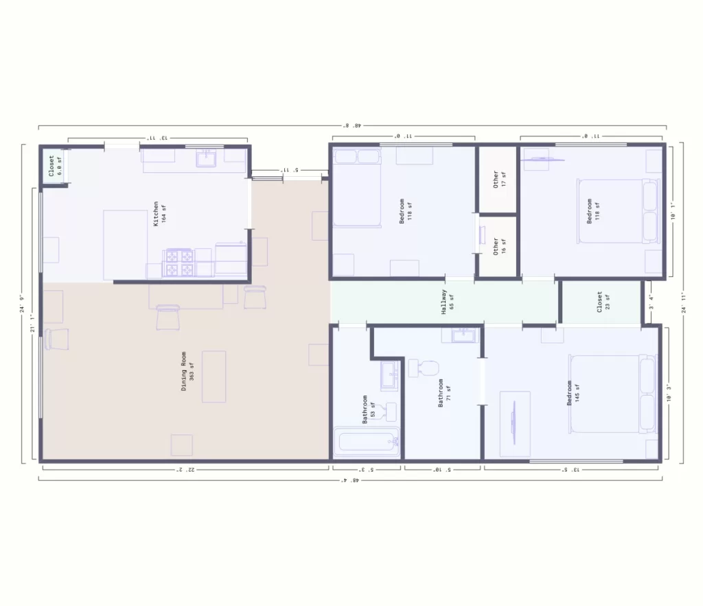
One of Caliber Public Adjusters’ standout features is its commitment to transparency and empowerment. The company provides homeowners with a free blueprint of their property, incorporating data gathered through drones, LiDAR, and satellite imaging. This blueprint not only serves as a visual representation of the property but also documents the damages and repairs needed in a comprehensive and easily understandable format.
This empowerment empowers homeowners to engage in meaningful conversations with their insurance providers. Armed with accurate and detailed information, homeowners can confidently negotiate for the compensation required to restore their property to its pre-damage state.
Seamless Settlements: Navigating the Insurance Landscape
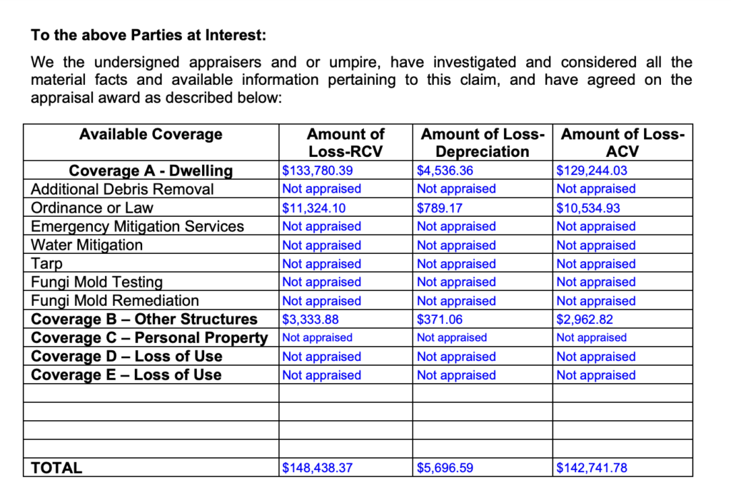
The core of Caliber Public Adjusters’ approach lies in its dedication to settling claims efficiently and equitably. Armed with precise aerial insights, advanced technology, and expert negotiation skills, the company works on behalf of homeowners to ensure that their insurance claims are handled with the utmost professionalism.
By combining the data-rich insights provided by drones, LiDAR, and aerial satellite imaging with their extensive industry expertise, Caliber Public Adjusters bridges the gap between homeowners and insurance companies. This not only expedites the claims process but also helps homeowners secure the financial resources needed to rebuild and recover.
Conclusion
Caliber Public Adjusters is at the forefront of a technological revolution in the insurance claims industry. By integrating drones, LiDAR technology, and aerial satellite imaging, the company is simplifying and enhancing the claims settlement process. Through the provision of free blueprints and skillful negotiation, Caliber is empowering homeowners to navigate the complex insurance landscape with confidence, ensuring they receive the compensation they rightfully deserve. In an era where technology is reshaping industries, Caliber Public Adjusters stands as a shining example of how innovation can create positive and transformative change.
Call or Text me anytime at my Personal Cell (786) 818-9642 or send me an email at Armando@CaliberAdjusters.com